
Biodiversity Conservation
The Pirini water catchment is important to Sasamuga village and many communities in South Choiseul in the Solomon Islands. It is the primary source of water for Sasamuga hospital and several nearby villages.
"The degradation of the catchment over the last few years has affected the water supply immensely," said Fred Patison, Ecosystem-based Adaptation Officer at the Secretariat of the Pacific Regional Environment Programme (SPREP).
An Ecosystem-based Adaptation Project in Choiseul, implemented by SPREP and funded by USAID, is planning to rehabilitate and restore natural forests in Choiseul Province that have been lost due to intense land clearing and logging operations. The Pirini water catchment is among the sites in which forest rehabilitation and restoration will occur.
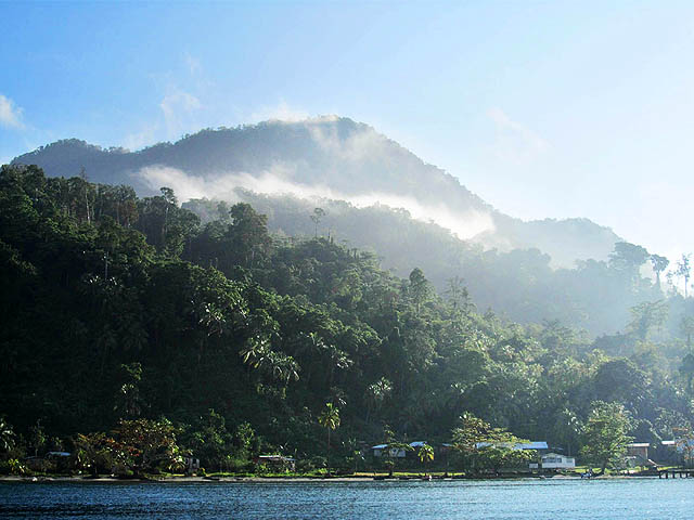
Photo: Southern Choiseul coastline
"The root systems that grow through regeneration of the forest will hold the soil together and reduce the amount of sediment flowing into the water catchment" said Mr Patison whilst visiting Samamuga in November 2014 with representatives from the Lauru Land Conference of Tribal Community and Solomon Island Government staff from the Ministry of Forests and the Ministry of Environment, Climate Change and Disaster Management and Meteorology.
Ecosystem-based adaptation activities such as this provide natural solutions that build resilience to climate change. As the Solomon Islands is expecting an increase in extreme rainfall events, measures such as reforestation are vital to protect communities from the risk of landslides, flooding and water supply contamination. SPREP project activities are to also include coastal zone replanting to reduce erosion of the foreshore in Sasamuga. In conjunction with local communities, SPREP is also planning activities for the capitol of Taro, the Rob Roy forest and the Mt Maetambe and Kolombangara river catchment.
In September 2014, a major planning meeting took place to further the concept of a 'Mount Maetambe and Kolobangara River Watershed Protected and Conservation Area'. It was hosted by SPREP, Ecological Solutions (a Solomon Islands based NGO), Lauru Land Conference of Tribal Communities (LLCTC) and the Choiseul Provincial Government.
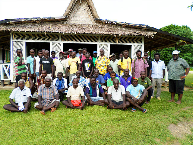
Photo: Meeting participants, Taro Choiseul, Sep 2014
Discussions took place regarding the Mt Maetambe project site amongst chiefs and community representatives from the almost 20 tribes who own land within the catchment, from Koloe Village to Kukumuni Village (in North Choiseul) and Kakasa Village to Sasamugga Village (in South Choiseul).
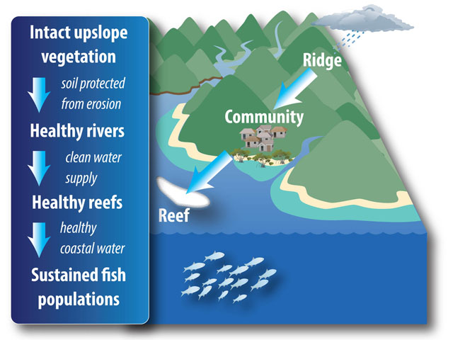
Diagram: Example of ridge to reef benefits
Protected areas on land, on the coastline and in the sea can mean a more sustainable future for Choiseul. They ensure that intact catchments provide a clean water supply, the sea continues to provide a reliable source of fish and decrease the risk of damage from natural disasters
Since communities in Choiseul are the principle resource owners and there is very little government owned or leased land, a ridge to reef approach must focus on the community as the central point for adaptation action. Through working closely with these communities SPREP will continue to implement Ecosystem-based Adaptation measures and ensure that natural solutions are a big part of the future for this beautiful and remote Province of the Solomon Islands.
"The degradation of the catchment over the last few years has affected the water supply immensely," said Fred Patison, Ecosystem-based Adaptation Officer at the Secretariat of the Pacific Regional Environment Programme (SPREP).
An Ecosystem-based Adaptation Project in Choiseul, implemented by SPREP and funded by USAID, is planning to rehabilitate and restore natural forests in Choiseul Province that have been lost due to intense land clearing and logging operations. The Pirini water catchment is among the sites in which forest rehabilitation and restoration will occur.
Photo: Southern Choiseul coastline
"The root systems that grow through regeneration of the forest will hold the soil together and reduce the amount of sediment flowing into the water catchment" said Mr Patison whilst visiting Samamuga in November 2014 with representatives from the Lauru Land Conference of Tribal Community and Solomon Island Government staff from the Ministry of Forests and the Ministry of Environment, Climate Change and Disaster Management and Meteorology.
Ecosystem-based adaptation activities such as this provide natural solutions that build resilience to climate change. As the Solomon Islands is expecting an increase in extreme rainfall events, measures such as reforestation are vital to protect communities from the risk of landslides, flooding and water supply contamination. SPREP project activities are to also include coastal zone replanting to reduce erosion of the foreshore in Sasamuga. In conjunction with local communities, SPREP is also planning activities for the capitol of Taro, the Rob Roy forest and the Mt Maetambe and Kolombangara river catchment.
In September 2014, a major planning meeting took place to further the concept of a 'Mount Maetambe and Kolobangara River Watershed Protected and Conservation Area'. It was hosted by SPREP, Ecological Solutions (a Solomon Islands based NGO), Lauru Land Conference of Tribal Communities (LLCTC) and the Choiseul Provincial Government.
Photo: Meeting participants, Taro Choiseul, Sep 2014
Discussions took place regarding the Mt Maetambe project site amongst chiefs and community representatives from the almost 20 tribes who own land within the catchment, from Koloe Village to Kukumuni Village (in North Choiseul) and Kakasa Village to Sasamugga Village (in South Choiseul).
Diagram: Example of ridge to reef benefits
Protected areas on land, on the coastline and in the sea can mean a more sustainable future for Choiseul. They ensure that intact catchments provide a clean water supply, the sea continues to provide a reliable source of fish and decrease the risk of damage from natural disasters
Since communities in Choiseul are the principle resource owners and there is very little government owned or leased land, a ridge to reef approach must focus on the community as the central point for adaptation action. Through working closely with these communities SPREP will continue to implement Ecosystem-based Adaptation measures and ensure that natural solutions are a big part of the future for this beautiful and remote Province of the Solomon Islands.