Being able to measure progress and outcomes towards marine spatial planning objectives in the Cook Islands was the focus of a consultation workshop held recently in Rarotonga. Partners in Marine Spatial Planning recently came together to co-design a country-specific engagement plan for the co-development of climate and biodiversity-smart marine spatial planning indicators for Cook Islands.
Marine Spatial Planning is a process that develops the blueprint to manage an area that has multiple management objectives.
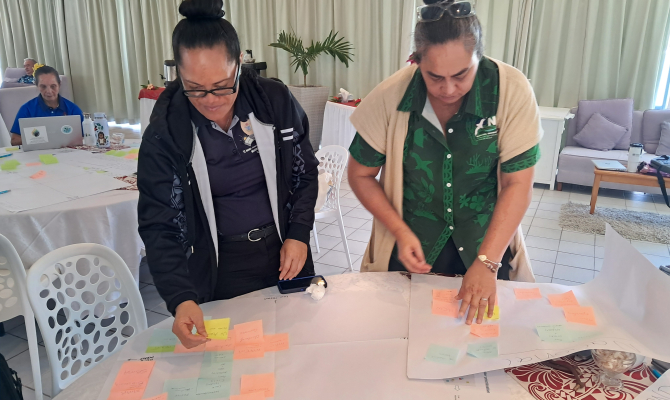
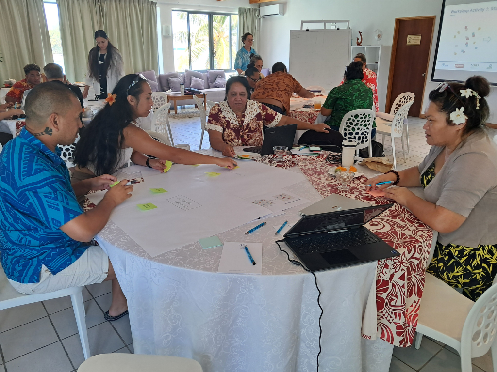
The goal of the workshop was to consult with key partners and to co-design an appropriate engagement plan for co-developing a suite of MSP indicators, tailored to the Cook Islands for monitoring and assessing the effectiveness of island-scale MSP processes across Rarotonga and the Pa Enua also known as the Outer Islands.
These indicators will align with the Cook Islands’ broader MSP objectives including ongoing work within the Marae Moana Cook Islands Marine Park which covers approximately 2 million square kilometres of the country’s exclusive economic zone.
“Co-developing and implementing indicators is essential for evaluating the effectiveness of the marine spatial planning process and tracking whether expected outcomes are being achieved for Cook Islands,” said Mr. Halatoa Fua, Director of the Cook Islands National Environment Service (NES).
“The holistic and integrated nature of marine spatial planning requires indicators that reflect multiple themes — from safeguarding biodiversity values, to supporting sustainable ocean-based livelihoods, to maintaining and strengthening cultural connections to the sea. Thus, I am pleased that we are taking the necessary steps towards measuring the impact of our MSP actions across these different dimensions.”
The workshop was co-organised by NES and the Secretariat of the Pacific Regional Environment Programme (SPREP) and is a key output of the New Zealand Ministry of Foreign Affairs and Trade -funded Climate and Biodiversity-Smart Marine Spatial Planning (CaB-Smart MSP) Project, implemented by SPREP.
During the workshop, key topics discussed included the linkages of the CaB-Smart MSP project to previous and existing national MSP work, key lessons learnt from past initiatives, an introduction to indicators, purpose and use and their application to marine spatial planning. Interactive sessions were held on stakeholder mapping, effective communication tools and methods, and consultation engagement planning which engaged partners on shaping the indicator co-development consultation and engagement process.
“The discussions and exchanges amongst partners present during the workshop were very positive. It was particularly encouraging to see constructive and enthusiastic contributions around the MSP stakeholder mapping at both national and island scales and the results thereof as well as collectively determining the engagement format for priority stakeholders,” said Mr Vainuupo Jungblut, the Environmental Monitoring and Reporting Adviser of SPREP.
“This feedback will greatly assist our team as we plan for the main process of co-developing the MSP indicators with key stakeholders.”
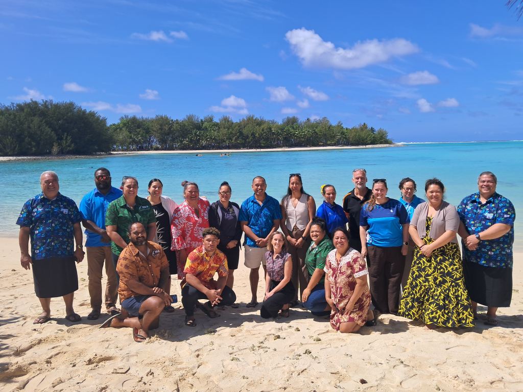
The workshop was delivered during the first of two in-country missions under the project and served as a preliminary in-country gathering with key national partners involved in marine spatial planning including the Marae Moana Coordination Office (Office of the Prime Minister), Seabed Minerals Authority, Climate Change Cook Islands, Ministry of Marine Resources, Ministry of Transport, and Te Ipukarea Society.
The resulting engagement plan will ensure that subsequent multi-stakeholder consultations during the second in-country mission are delivered in a way that is tailored to the national context and aligns with existing work on the ground and would also ensure that the co-developed indicators reflect national priorities, cultural context and data availability of the Cook Islands, ensuring they are practical, relevant, and useable by stakeholders on the ground.
The national MSP partners consultation workshop held on Wednesday 16 September was conducted by BMT Commercial Australia Pty Ltd under contract to SPREP and was made possible through the Climate and Biodiversity-Smart Marine Spatial Planning Project (CaB-Smart MSP), funded by the New Zealand Ministry of Foreign Affairs and Trade. The CaB-Smart MSP Project underscores New Zealand’s commitment to assist Pacific Island nations in addressing and adapting to the challenges posed by climate change, it is part of New Zealand's broader International Climate Finance Strategy and aims to bolster the capabilities and capacities of Pacific Island countries to lead tailored approaches to marine spatial planning and marine protection. These approaches are designed to enhance marine conservation efforts, balance economic and conservation objectives, and fortify resilience against the adverse impacts of climate change.
SPREP is leading on two multi-country components of the project, which have a specific focus on strengthening understanding of how Traditional Knowledge and customary practice work alongside marine spatial planning and developing country-specific climate and biodiversity-relevant marine spatial planning indicators. Implementation of the project is being closely coordinated with regional partners including The Pacific Community (SPC) and aligns with and contributes to key regional frameworks such as the 2050 Strategy for the Blue Pacific Continent, the Framework for a Pacific Oceanscape and the Pacific Islands Regional Ocean Policy.
For more information on the CaB-Smart MSP project, please contact Vainuupo Jungblut
Environmental Monitoring and Reporting Adviser (vainuupoj@sprep.org) and/or Mr. Patea Setefano, CaB Smart MSP Project Coordinator (patea.ext@sprep,org)