
Biodiversity Conservation
A training in real-world data collection using Global Positioning System (GPS) and data analysis using Geographical Information Systems (GIS) was completed last week for staff of the Samoa Ministry of Natural Resources and Environment (MNRE) who deal with Protected Area management.
"The collection of accurate spatial data, coupled with the ability to import, analyse and manage it, is critical for monitoring and reporting on our environment at the national level, and for regional and international commitments" said Mr Ryan Wright, Lead Trainer and Spatial Planning Officer at the Secretariat of the Pacific Regional Environment Programme (SPREP).
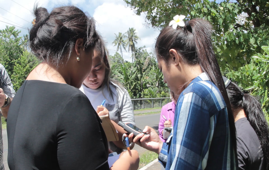
Stage 1: Conservation officers record essential spatial data with their GPS units. Photo: SPREP
The training was organised and implemented under the Biodiversity and Protected Areas programme of SPREP and the Marine and Coastal Biodiversity Management in the Pacific Island Countries (MACBIO) project, as part of SPREPs efforts to promote regional uptake of lessons and outcomes in MACBIO.
"This training will provide MNRE staff with the specific skillsets for a range of activities, including integrated coastal zone planning, accurately mapping their protected areas and updating their national protected area dataset. These efforts will place Samoa in a strong position to achieve global, regional and national targets and priorities," said Amanda Wheatley, Ecosystems and Biodiversity Officer at SPREP.
Participants received field training to apply theoretical knowledge about GPS, capturing data for monitoring of three nature reserves in the Apia area, including boundaries, important features and associated assets.
During the next session participants went back to the office where they were taught the theory behind GIS and learnt how to import, style, label and manage the important spatial data they captured in the field using their GPS devices. Participants created their own workspaces, reviewed their collected data and created a spatial accurate protected area, calculated it's area and then created professional maps for use in reports.
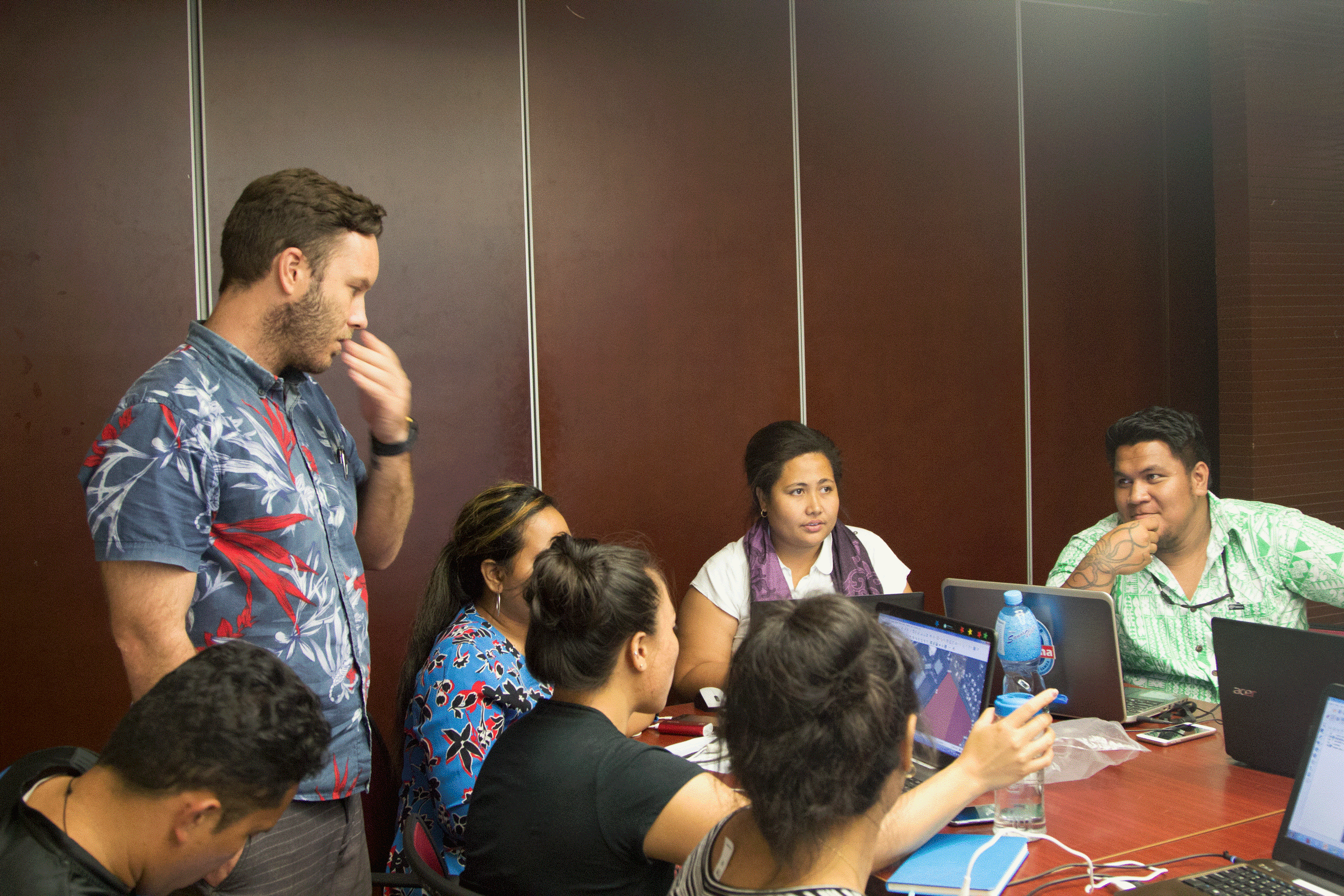
Stage 2: Conservation officers import essential spatial data with their GIS program. Photo: SPREP
"Understanding GIS is crucial in our current efforts by assessing and validating ecological representation of the existing protected area programmes in Samoa. Such technology is valuable to visualize and present suitable data to optimise our work with key areas that are very significant to conservation and protection of our natural resources such as marine and terrestrial biodiversity. Using GIS and available GIS tools can accelerate our confidence in planning surveys and research and challenges in the field for data collection.
We aim to collect and validate the existing information on protected areas both terrestrial and marine to achieve the highest rate of biodiversity conservation in Samoa," said Czarina Iese-Stowers of the MNRE.
The training held on 28 September was made possible through assistance from SPREPs Programme of Support for Protected Areas and input from Ryan Wright, Spatial Planning Officer for the MACBIO project.
"The collection of accurate spatial data, coupled with the ability to import, analyse and manage it, is critical for monitoring and reporting on our environment at the national level, and for regional and international commitments" said Mr Ryan Wright, Lead Trainer and Spatial Planning Officer at the Secretariat of the Pacific Regional Environment Programme (SPREP).
Stage 1: Conservation officers record essential spatial data with their GPS units. Photo: SPREP
The training was organised and implemented under the Biodiversity and Protected Areas programme of SPREP and the Marine and Coastal Biodiversity Management in the Pacific Island Countries (MACBIO) project, as part of SPREPs efforts to promote regional uptake of lessons and outcomes in MACBIO.
"This training will provide MNRE staff with the specific skillsets for a range of activities, including integrated coastal zone planning, accurately mapping their protected areas and updating their national protected area dataset. These efforts will place Samoa in a strong position to achieve global, regional and national targets and priorities," said Amanda Wheatley, Ecosystems and Biodiversity Officer at SPREP.
Participants received field training to apply theoretical knowledge about GPS, capturing data for monitoring of three nature reserves in the Apia area, including boundaries, important features and associated assets.
During the next session participants went back to the office where they were taught the theory behind GIS and learnt how to import, style, label and manage the important spatial data they captured in the field using their GPS devices. Participants created their own workspaces, reviewed their collected data and created a spatial accurate protected area, calculated it's area and then created professional maps for use in reports.
Stage 2: Conservation officers import essential spatial data with their GIS program. Photo: SPREP
"Understanding GIS is crucial in our current efforts by assessing and validating ecological representation of the existing protected area programmes in Samoa. Such technology is valuable to visualize and present suitable data to optimise our work with key areas that are very significant to conservation and protection of our natural resources such as marine and terrestrial biodiversity. Using GIS and available GIS tools can accelerate our confidence in planning surveys and research and challenges in the field for data collection.
We aim to collect and validate the existing information on protected areas both terrestrial and marine to achieve the highest rate of biodiversity conservation in Samoa," said Czarina Iese-Stowers of the MNRE.
The training held on 28 September was made possible through assistance from SPREPs Programme of Support for Protected Areas and input from Ryan Wright, Spatial Planning Officer for the MACBIO project.