
19 June 2023, Port Vila - The Sarakata River, on Vanuatu’s Espiritu Santo island, runs through the middle of the most densely populated urban centre in Vanuatu, Luganville town. Around 5,000 people, which is 25 percent of Luganville’s population, currently live in houses which are exposed to a moderate, high, or very high flood risk.
Extreme rainfall events and cyclones cause frequent flooding of the Sarakata River catchment and forced evacuations have occurred in recent years in the Mango, Pepsi, Solway and Sarakata informal settlements, the most vulnerable areas of the catchment.
A 2016 report assessed that flood damage in the ‘moderate’, ‘heavy’ or ‘very heavy’ ranges could lead to deaths without evacuation, and that people would be at risk of being swept away by fast-flowing floodwaters. On top of this, climate models for Vanuatu predict that anthropogenic climate change is increasing the severity of extreme rainfall events, which means the Sarakata River catchment can expect increased flooding in future.
To reduce the severity of the hazard to life and property from flooding within the catchment, the Climate Information Services for Resilient Development Planning in Vanuatu Project (known locally by its Bislama acronym, VanKIRAP) has been tackling this challenge with two major activities.
Firstly, VanKIRAP installed an automated river gauge (ARiG) 10 km upstream of Luganville in September 2022. This is the first automated hydrological monitoring undertaken on the river. The gauge reports the river level, river discharge, rate of rise, rainfall total, rainfall intensities and other parameters at five-minute intervals and transmits data via mobile phone network, with satellite redundancy if the mobile network goes down. Data from the station are transmitted to the Vanuatu Meteorological and Geohazards Department (VMGD) for monitoring. The data are also available publicly on a dashboard website.
The data will also be used in VanKIRAP’s other activity to strengthen resilience to flooding hazards in the catchment: a flood management plan (FMP) and early warning system (EWS). The first of its kind, The Sarakata River Catchment Flood Management Plan and Early Warning System has been produced for the VanKIRAP Project by New Zealand based environmental and engineering consultancy, Tonkin + Taylor.
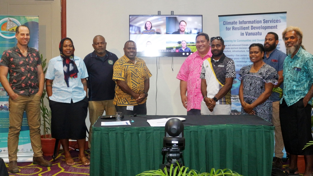
Last week, Tonkin + Taylor presented the Sarakata FMP/EWS to Vanuatu’s water sector stakeholders at a workshop in Port Vila. Participants at the workshop were able to give their assessment of the Plan and provide feedback to better allocate roles and responsibilities in the Plan's standard operating procedures. This will ensure that when the final plan is officially handed over by VanKIRAP to the Vanuatu Government, it will significantly improve the Vanuatu Government’s ability to mitigate flooding in the catchment.
During the workshop, VanKIRAP Project Manager, Ms Moirah Matou noted that VanKIRAP’s two activities to strengthen climate resilience in the Sarakata River catchment complement one another.
“Communities not only need scientific hazard information, but information too about how to ensure protect themselves and their property. The scientific observation equipment we have installed in the river provides the data, while the Flood Management Plan and Early Warning System tells Government and communities how to act on the data when facing a flooding hazard within the Sarakata River catchment.”
In attendance at the workshop were representatives from the Secretariat of the Pacific Regional Environment Programme (SPREP), Vanuatu’s Department of Water Resources, VMGD, Vanuatu Public Works Department, the National Disaster Management Office, Vanuatu Red Cross, and the United Nations Satellite Centre.
Another workshop will be held in Luganville on Monday, 19 June for stakeholders in Espiritu Santo. The finalised Sarakata River Catchment Flood Management Plan and Early Warning System report is due for completion by 30 June for an official handover to the Vanuatu Government in July. Funding support for VanKIRAP’s Sarakata River catchment activities has been provided by the Green Climate Fund (GCF).
The Vanuatu Klaemet Infomesen blong Redy, Adapt mo Protekt (Van-KIRAP) project is a five-year, USD 22 million project which aims to support climate resilient development in Vanuatu through the development, communication, and application of climate information services to benefit agriculture, fisheries, tourism, infrastructure, waste sectors and communities. The project is implemented by the Secretariat of the Pacific Regional Environment Programme in partnership with the Vanuatu Meteorology and Geo-hazards Department, Commonwealth Scientific and Industrial Research Organisation, Australian Bureau of Meteorology, and APEC Climate Center.
For more information, please contact Mr Sunny Seuseu, VanKIRAP Acting Manager, at sunnys@sprep.org