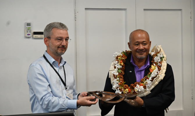
5 August 2025, Suva - Pacific Small Island Developing States (PSIDS) gathered in Suva last week for the 2025 Regional Dialogue Forum for Pacific SIDS, under the theme “Geospatial Data to Support Monitoring and Integrated Planning for Achieving Land Degradation Neutrality, Climate Change, and Biodiversity Goals” as part of the GEOdata4LDN+ initiative.
The Forum was co-hosted by the United Nations University – Institute for Environment and Human Security (UNU-EHS), the GEO-LDN Flagship, and the Government of Fiji through its Ministry of Agriculture and Waterways. The Secretariat of the Pacific Regional Environment Programme (SPREP) and The Pacific Community (SPC) were collaborating partners involved in the initial planning and support for Pacific small island states in the build up to the event.
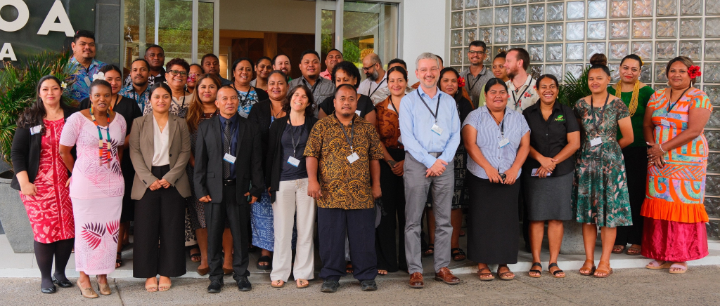
The three-day event, held from 22–24 July, brought together geospatial experts, government representatives, and regional partners to advance the use of Earth Observation and spatial data in support of sustainable land management, climate resilience, and biodiversity conservation across the Pacific. The meeting served as a platform for country teams to present case studies, identify data gaps, and strengthen technical capacity for reporting under three global Multilateral Environmental Agreements - the United Nations Convention to Combat Desertification (UNCCD), the United Nations Framework Convention on Climate Change (UNFCCC), and the Convention on Biological Diversity (CBD).
Held at the Tanoa Plaza Hotel, the forum engaged 43 participants from across the Pacific Islands region.
In his opening address, Dr. Andrew Tukana, Permanent Secretary for Fiji’s Ministry of Agriculture and Waterways, emphasised the urgency of tackling land degradation within the Pacific context. “Pacific Small Island States are not exempted from land degradation, but the issue extends beyond the environment, posing serious economic, social, and cultural challenges that now threatens livelihoods, disaster resilience, and biodiversity”.
Climate change is amplifying these threats, as severe weather events accelerate land degradation in vulnerable ecosystems. For PSIDS, “these challenges are compounded by limited access to high-resolution geospatial data and the small size and fragility of island territories,” said Dr. Tukana.
He also acknowledged the importance of global and regional partnerships in supporting Pacific Small Island Developing States.
With strong support from SPREP and SPC, the forum promoted peer-to-peer learning and cross-sectoral exchange. Sessions focused on the practical application of high-resolution geospatial datasets, monitoring land degradation (SDG 15.3.1), integrated land use planning (ILUP), and harnessing geodata synergies to achieve multiple environmental objectives.
In a dedicated session, SPREP’s GIS team, highlighted the organisation’s regional leadership in environmental governance, capacity building, and geospatial data management. Their presentation emphasised the role and practical application of GIS and Earth Observation tools in supporting decision-making for climate adaptation, biodiversity protection, waste management, and disaster risk reduction.
“It was a privilege for SPREP to contribute as a technical expert at this Regional Dialogue Forum,” said Ms Kasaqa Tora, Spatial Analyst Specialist – Protected Areas at SPREP. “The gathering provided a valuable opportunity to connect with participants from Pacific Island Countries and collaborate with other regional and international geospatial experts. Together, we facilitated discussions and shared ideas on how to strengthen collaboration using geospatial data to support countries in meeting their reporting obligations under the three Rio Conventions.”
The Dialogue Forum forms part of the GEO-LDN peer-to-peer country support network and contributes to the development of the LDN Toolbox. It also offers an opportunity for Pacific Small Island Developing States to inform the design of tools and datasets relevant to their contexts, ahead of the UNCCD 2026 reporting cycle.
“Geospatial solutions are empowering Pacific Island countries to tackle their unique environmental challenges through locally informed, globally aligned actions,” said Ms Vani Koroisamanunu, Environmental GIS Specialist at SPREP. “This forum reinforces the collaborative foundation essential for sustaining long-term environmental monitoring and reporting.”
The Forum concluded with commitments to deepen regional collaboration, invest in national geospatial capacities, and to continue the integration of geospatial data into climate, biodiversity, and land use policies for a resilient Pacific future.
SPREPs participation in the forum was made possible through funding from GEO-LDN and supported by the NZMFAT and Emma Luke Trust initiative. Furthermore, SPREP engagement and contributions reinforced its commitment to supporting Pacific Island countries in environmental monitoring, conservation, and governance and highlighting the value of regional collaboration in advancing discussions and action on regional sustainability.
To find out more about the Emma Luke Trust initiative, please contact Mr. Vainuupo Jungblut at vainuupoj@sprep.org
For the NZMFAT project, please contact Mrs. Vani Koroisamanunu at vanik@sprep.org
For more information on the GEOdata4LDN+ initiative and the Forum, visit: https://geo-ldn.org/events/psids-dialogue-forum-2025/