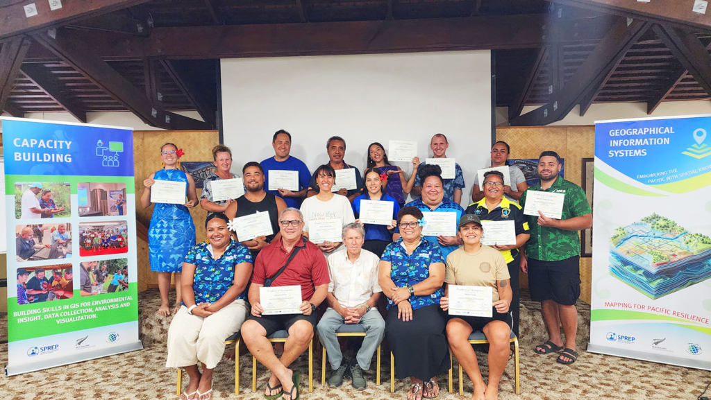
Growing skill sets to use GIS tools and data collection for mapping, was at the core of training underway in the Cook Islands. The Secretariat of the Pacific Regional Environment Programme (SPREP), in collaboration with the Cook Islands National Environment Service (NES), successfully conducted a four-day Geographic Information System (GIS) and Data Management Training in Rarotonga from 28–31 October 2025.
The training was funded by the European Union (EU) under the Pacific BioScapes Programme, the third phase of the ‘capacity building related to Multilateral Environmental Agreements in African, Caribbean and Pacific States’ (ACP MEAs Phase III), and the New Zealand Ministry of Foreign Affairs and Trade (NZMFAT) Climate Change Policy, Operational and Advisory, and Enabling and Support initiatives.
The training brought together 28 participants from government agencies, non-governmental organisations, conservation groups, academic institutions, and community organisations. This diverse, gender-balanced group reflected the Cook Islands’ collaborative and inclusive approach to advancing conservation through spatial technologies.
The event was officially opened by the Director of the National Environment Service (NES), Mr. Halatoa Fua, who emphasised the importance of integrating geospatial technology into conservation management to strengthen evidence-based decision-making. The Director commended the partnership between NES and SPREP for enhancing national technical capacity and fostering collaboration among local and regional stakeholders working to safeguard the country’s unique biodiversity.
Over four days, participants engaged in classroom sessions, hands-on exercises, and fieldwork designed to build practical skills in spatial data collection, analysis, and visualisation. Using open-source tools such as QGIS and QField, they learned to map habitats, track species, and manage biodiversity data.
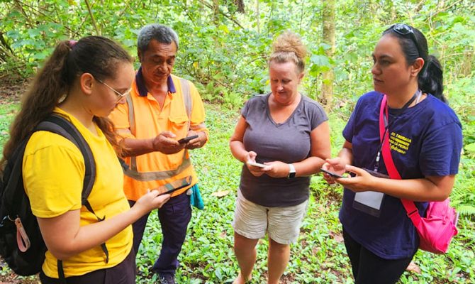
The field component focused on the Takitumu Conservation Area (TCA), an important forest ecosystem and the Pacific’s first officially registered Other Effective Area-Based Conservation Measure (OECM). Home to the endemic Kākerōri (Rarotonga Flycatcher, Pomarea dimidiata), the TCA stands as a global success story where community-led conservation efforts have brought the species back from the brink of extinction. Participants used QField and QGIS to collect and analyse geotagged data on bird species and habitat conditions, demonstrating how spatial tools can practically support local biodiversity monitoring and conservation planning.
SPREP Spatial Analysis Specialist for Protected Areas, Kasaqa Tora, said, that “Equipping participants with the skills to use data collection tools and understand GIS functions is essential. It was inspiring to see them not only engaged and satisfied with the training but already exploring how to apply these tools in their own work—an encouraging and impactful outcome of the programme.”
The training also introduced Earth Observation (EO) applications, highlighting and demonstrating how satellite imagery and EO products complement field-based data to monitor habitat change, assess threats, and support long-term conservation strategies. This component aligned with the role of the Emma Luke Earth Observation Centre (ELEOC) hosted by SPREP as a regional hub providing access to EO data, tools, and expertise, and the Pacific Earth Observation Network (PEON), a growing community of practice connecting Pacific practitioners and partners to strengthen regional EO understanding and capacity.
SPREPs Environment GIS Specialist, Vani Koroisamanunu, highlighted “the importance of training in enhancing GIS and Earth Observation capacity that will enable nations like the Cook Islands to make informed decisions that strengthen biodiversity conservation and advance global goals under the Convention on Biological Diversity and the Sustainable Development Goals.”
Participants also explored the Pacific Islands Protected Area Portal (PIPAP), reviewing Cook Islands’ protected area data to ensure accuracy and alignment with global biodiversity databases. This work directly contributes to achieving Target 3 of the Kunming-Montreal Global Biodiversity Framework in particular the the 30×30 goal.
NES acknowledged that the skills gained will enhance ongoing national conservation initiatives, including improved monitoring and reporting of protected areas such as the TCA. Participants also heard a presentation from IUCN Ocean Regional office on the work they are doing on Marine Special Planning (MSP) in Cook Islands through the EU funded Pacific BioScapes Programme. The presentation focused on spatial data and the utilisation of tools to undertake analysis to identify ecologically sensitive marine zones within the Cook Islands’ EEZ for inclusion in the MSP zones.
The workshop concluded with reflections from participants who expressed appreciation for the opportunity to engage with peers across conservation, science, and community sectors. The multi-stakeholder and gender-balanced participation fostered stronger collaboration and inclusivity, reinforcing the Cook Islands’ commitment to leverage spatial tools and regional partnerships for sustainable biodiversity management.
This training marks another milestone in advancing national and regional capabilities in spatial data for conservation—laying the foundation for informed environmental management and resilience to climate and biodiversity challenges across the Pacific. It reinforces SPREP’s commitment to supporting the Cook Islands and other Pacific Island countries in environmental governance and sustainability.
For more information:
• Pacific BioScapes Programme: Mr. Etienne Delattre – etienned@sprep.org
• ACP MEAs 3 Project: Mrs. Anastacia Amoa-Stowers – anastacias@sprep.org
• NZMFAT Project/GIS work undertaken by SPREP: Mrs. Vani Koroisamanunu – vanik@sprep.org