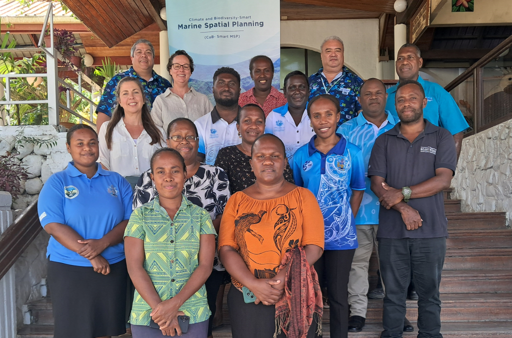
8 October 2025, Honiara - Monitoring the progress and impact of the marine spatial planning (MSP) process in Solomon Islands was the focus of a national MSP partners consultation workshop held recently in Honiara.
The workshop was to consult with key partners and to co-design an appropriate engagement plan for co-developing a suite of MSP indicators, tailored to Solomon Islands for monitoring and assessing the effectiveness of island-scale MSP processes across several provinces.
Marine Spatial Planning is a process for managing multiple human activities in a country’s coastal and marine areas to achieve balanced ecological, economic, and social objectives. A fundamental aspect of MSP is the use of environmental, social, economic and cultural indicators to evaluate the effectiveness of MSP processes and confirm the delivery of desired outcomes.
These indicators will align with Solomon Islands’ MSP objectives and policy frameworks, specifically the Solomon Islands’ National Ocean Policy (SINOP), the Solomon Islands MSP plan and as well as broader national priorities around marine conservation and ocean management.
Furthermore, the indicators will contribute to relevant national reporting obligations, including the national State of Environment (SoE) reporting process for Solomon Islands.
“Our Ocean is at the heart of our food security, culture, and identity. But climate change and biodiversity loss mean we must adapt how we manage it,” said Mr. Josef Hurutarau, Director for Environment and Conservation, Solomon Islands Ministry of Environment, Climate Change, Disaster Management and Meteorology (MEDCM)
“Marine Spatial Planning (MSP) is about building the resilience of our communities, protecting our healthy ecosystems, and ensuring a sustainable future for our people and nation. I am pleased to note that the process to co-develop tailored and country-specific MSP indicators is underway with the initial step of co-designing a tailored stakeholder engagement strategy this week.”
He added: “This work is of critical importance to Solomon Islands and will complement our current MSP process and activities implemented over the past two years. This initiative is well positioned to mobilise action and deliver lasting benefits for our coastal communities and marine environment. I commend SPREP and our national partners and also acknowledge the financial assistance of the New Zealand MFAT for supporting this important work for Solomon Islands.”
The workshop was co-organised by Solomon Islands Ministry of Fisheries and Marine Resources (MFMR) and the Secretariat of the Pacific Regional Environment Programme (SPREP), working closely with MEDCM. The workshop is a key output of the New Zealand Ministry of Foreign Affairs and Trade -funded Climate and Biodiversity-Smart Marine Spatial Planning (CaB-Smart MSP) Project, implemented by SPREP.
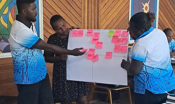
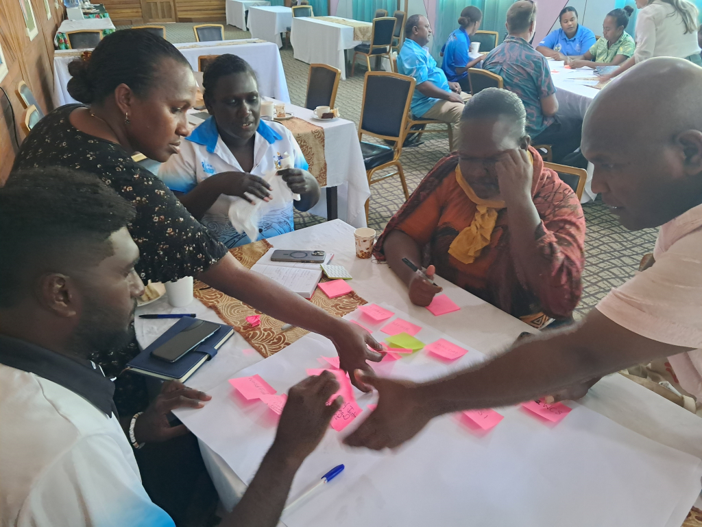
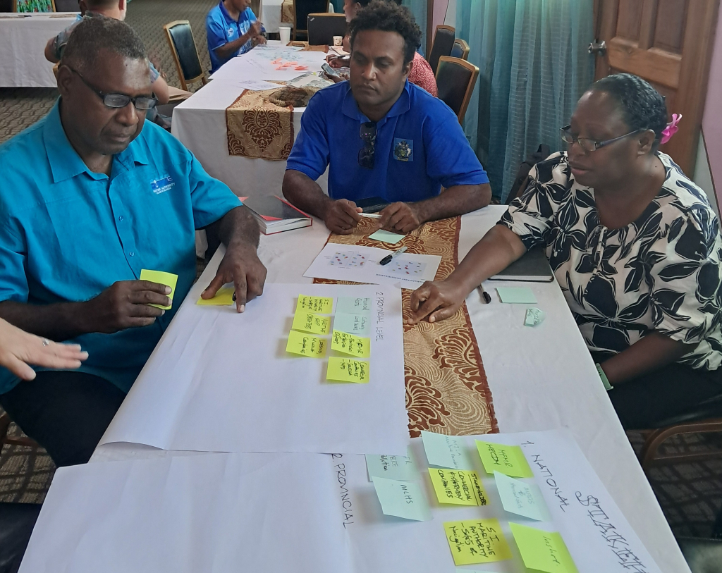
During the workshop, key topics discussed included the linkages of the CaB-Smart MSP project to previous and existing national MSP work, key lessons learnt from past initiatives, an introduction to indicators, purpose and use and their application to marine spatial planning.
Interactive sessions were held on stakeholder mapping at national and provincial levels, effective communication tools and methods, and consultation engagement planning which engaged partners on shaping the indicator co-development consultation and engagement process.
“Because marine spatial planning aims to find a balance across human activities in the ocean space, the fact that people are at the core of the MSP process cannot be overstated,” said Ms. Faye Siota, Deputy Director of Inshore Fisheries, Solomon Islands Ministry of Fisheries and Marine Resources.
“For Solomon Islands, MSP should strengthen cultural connections between our communities and the ocean and reflect traditional governance protocols and structures. I am happy to have been part of the good discussions during the workshop, particularly around co-designing an effective strategy for the inclusive and meaningful engagement of all relevant stakeholders in the co-development of indicators.
“Measuring how well our MSP process is meeting its objectives, especially those that involve cultural resilience, the good health of marine resources and long-term prosperity of our coastal communities for socio-economic benefits is an important undertaking.”
The workshop was delivered during the first of two in-country missions under the project and served as a preliminary in-country gathering with key national partners involved in marine spatial planning including the Ministry of Environment (MECDM), Ministry of Fisheries (MFMR), Solomon Islands Maritime Authority (SIMA), Ministry of Lands, Housing and Survey (MLHS) and Ministry of Justice and Legal Affairs (MJLA).
“The discussions and views collated during the workshop has greatly assist our team in determining the most suitable engagement strategy for co-developing the MSP indicators with key stakeholders,” said Mr Vainuupo Jungblut, the Environmental Monitoring and Reporting Adviser of SPREP.
The resulting engagement plan will ensure that subsequent multi-stakeholder consultations during the second in-country mission are delivered in a way that is tailored to the national context and aligns with existing work on the ground and would also ensure that the co-developed indicators reflect national priorities, cultural context and data availability of Solomon Islands, ensuring they are practical, relevant, and useable by stakeholders on the ground.
The national MSP partners consultation workshop held on Tuesday 30 September was conducted by BMT Commercial Australia Pty Ltd, partnering with Griffith University under contract to SPREP and was made possible through the Climate and Biodiversity-Smart Marine Spatial Planning Project (CaB-Smart MSP), funded by the New Zealand Ministry of Foreign Affairs and Trade.
The CaB-Smart MSP Project underscores New Zealand’s commitment to assist Pacific Island nations in addressing and adapting to the challenges posed by climate change, it is part of New Zealand's broader International Climate Finance Strategy and aims to bolster the capabilities and capacities of Pacific Island countries to lead tailored approaches to marine spatial planning and marine protection. These approaches are designed to enhance marine conservation efforts, balance economic and conservation objectives, and fortify resilience against the adverse impacts of climate change.
SPREP is leading on two multi-country components of the project, which have a specific focus on strengthening understanding of how Traditional Knowledge and customary practice work alongside marine spatial planning and developing country-specific climate and biodiversity-relevant marine spatial planning indicators. Implementation of the project is being closely coordinated with regional partners including The Pacific Community (SPC) and aligns with and contributes to key regional frameworks such as the 2050 Strategy for the Blue Pacific Continent, the Framework for a Pacific Oceanscape and the Pacific Islands Regional Ocean Policy.
For more information on the CaB-Smart MSP project, please contact Vainuupo Jungblut
Environmental Monitoring and Reporting Adviser vainuupoj@sprep.org and/or Mr. Patea Setefano, CaB Smart MSP Project Coordinator patea.ext@sprep.org