
15 March 2023, Honiara, Solomon Islands – A data workshop focused on identifying and collating updated datasets from stakeholders that will enhance the spatial analysis of the network of protected areas in the Solomon Islands was conducted by the Secretariat of the Pacific Regional Environment Program (SPREP) through its Environmental Monitoring and Governance (EMG) programme this week.
The workshop, was conducted as part of the International Union Conservation for Nature (IUCN) project on _Ensuring Resilient Ecosystems and Representative Protected Areas in the Solomon Islands (EREPA). The workshop was co-facilitated through technical support provided by SPREP, and the Solomon Islands Ministry of Environment, Climate Change, and Disaster Management & Meteorology (MECDM), through the Environment and Conservation Division.
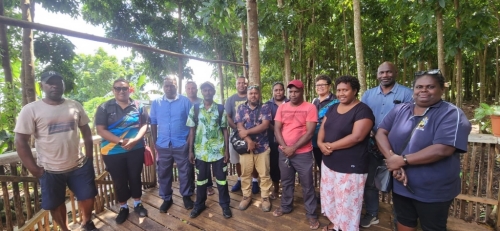
The stakeholders also conducted a field visit to one of the EREPA project sites in the Guadalcanal province, the Barana Community Nature Park which is supported and managed by the local community. The visit included activities like local community farming initiatives and the planting of native tree seedlings by stakeholders.
The scope of the EREPA project is to establish a network of protected areas in Guadalcanal, Malaita, Renell-Bellona, and Temotu provinces where the project is being implemented by the International Union for the Conservation of Nature (IUCN). Through the project component, a data gap analysis was conducted by SPREP to address the delineation of the protected areas to achieve healthy, productive, and restored landscapes in the four provinces.
In his opening remarks, Deputy Director of the Environment and Conservation Division, Mr. Josef Hurutarau stated that the EREPA project “will contribute to addressing terrestrial biodiversity loss and ecosystem decline through the improved management of natural resources, the creation of protected and conserved areas within four Key Biodiversity Areas, and the strengthening of the policy framework for the creation, management, and maintenance of protected areas to support Solomon Islands in meeting its commitments under multilateral environment agreements”.
Director of SPREP’s EMG programme, Mr. Jope Davetanivalu, acknowledged the stakeholders present during the workshop for their continued support in the strengthening of data-driven decision-making, particularly in providing information relating to identifying areas of environmental importance using geospatial information, to preserve the pristine ecosystem within the four provinces.
At the closing of the workshop Mr. Davetanivalu acknowledged the engagement of the stakeholders and reaffirmed SPREP’s commitment to continuing its collaboration with national counterparts to further the shared objectives for informed decision-making in ensuring resilient ecosystems for the Solomon Islands.
Acknowledge the support provided by the European Union-United Nations Environment Programme-funded Africa, Caribbean and Pacific Multilateral Environmental Agreements 3 (ACP/MEA 3) Project, as well as the Global Environment Facility/UNEP-funded Inform Project and the Organisation for African, Caribbean, and Pacific States (OACPS) BIOPAMA Project through the engagement of the GIS experts based at SPREP to deliver this workshop .
For more information on the EREPA Project, please contact Ms. Amanda Wheatley at amandaw@sprep.org
For more information on the Inform Project, please contact Ms. Vani Koroisamanunu at vanik@sprep.org, for the BIOPAMA project, Ms. Kasaqa Tora at kasaqat@sprep.org, and for the ACP/MEA 3 project please contact Ms. Anastacia Amoa-Stowers at anastacias@sprep.org.