
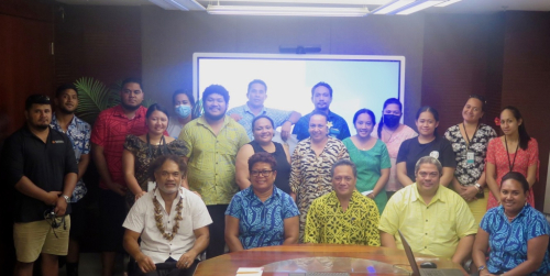
A national training for government officers across the environment and fisheries sectors as well as non-government organisations co-organised and implemented by the Secretariat of the Pacific Regional Environment Programme (SPREP) and the Samoa Ministry of Natural Resources and Environment (MNRE) was completed last week.
The objective of the training was twofold - to train targeted personnel in the use of upgraded features of the Pacific Islands Protected Area Portal (PIPAP) and how to access decision support tools, and to train personnel in geographic information systems (GIS) utilising free, open-source GIS software and recording spatial data in the field to produce basic maps of protected and conserved areas. The training served as a refresher for those who participated in earlier SPREP-facilitated trainings held in 2020, and also a first time for new government staff who participated.
The training was held in conjunction with the third meeting of the national Protected Areas Advisory Committee (PAAC), a multi-stakeholder committee comprising both government and NGO representatives charged with ensuring Samoa’s protected area targets and priorities are met through a coordinated and inclusive manner, among others. One of the items on the agenda for the PAAC meeting was Samoa’s contribution to the development and finalisation of the protected areas goal and target of the Global Biodiversity Framework 2030.
‘’This week, MNRE and SPREP are happy to host this third meeting of the Protected Areas Advisory Committee and the PIPAP-GIS training for technical and field staff from our ministry and key stakeholders who are important to the field data collection effort and for working closely with our local communities.’’ Said Ms. Lealaisalanoa Frances Brown, Chief Executive Officer of the MNRE during her welcome remarks.
The training equipped participants with practical knowledge of finding relevant up-to-date data, information resources and technical guidance, to assist planning for protected and conserved area planning and management. They are also able to use spatial data and Geographic Information System (GIS) software to produce and export basic protected area maps with standard features.
The Principal Officer, Reserves and Protected Areas of MNRE, Mr Su’emalo Talie Foliga, said the skills and knowledge gained through the training would greatly assist them with planning and decision-making processes, especially for sites currently earmarked for protection and conservation.
“Through hands-on exercises, participants learnt that the Pacific Islands Protected Area Portal is a reliable source of consolidated information and decision support tools and they acquired valuable technical skills to capture spatial data and easily make site maps,” said Mr Foliga.
“The training has been a valuable experience especially for those who were able to participate over the two days, including junior technical officers from both MNRE and the Samoa Fisheries Division. This training addresses a key priority for Samoa, and we are very grateful to SPREP and the BIOPAMA Programme for the continuous support and assistance provided.”
On the first day of the training, a brief introduction and online demonstration of the tools and features of the PIPAP was conducted, complemented by practical exercises where participants learnt how to access and conduct simple interpretation of their national protected area data, carry out basic and advanced searches for information resources using the portal’s search function, create descriptive site-based profiles and drawing basic site boundaries, and accessing decision support tools and technical guidance on different aspects of protected and conserved area planning and management available through the portal.

Day two covered the basic concepts of GIS and provided participants with practical skills in the use of free open-source software (QGIS) to view existing spatial datasets, including practical field data capture, adding spatial data layers and produce basic site maps with a standard layout - title, scale, descriptive labels, legend and clear boundaries. Furthermore, participants learnt how to export the maps to different formats.
“A key goal of this training was to demonstrate the relevance of, and value that the PIPAP portal and GIS skills can add to different aspects of the participants’ daily work, particularly related to assisting planning and supporting decision making for Samoa’s protected and conserved areas. I am happy that we have been able to deliver on this priority capacity need for Samoa, collaborating closely with our colleagues at MNRE,” said Mr Vainuupo Jungblut, Protected Areas Officer, SPREP.
“Follow-up technical assistance will be provided in the coming months, as required.”
The PIPAP-GIS training and the third PAAC meeting for Samoa, held from 22-23 June 2022 were funded through the BIOPAMA Programme, an initiative of the Organisation of African, Caribbean and Pacific (OACPS) Group of States financed by the European Union 11th European Development Fund.
In the Pacific, the project is implemented by IUCN Oceania in partnership with SPREP and the European Commission Joint Research Centre. This partnership has assisted the SPREP Regional Programme of Support for Protected Areas (SPREP-PA) to become a decision-making support hub, including delivering capacity building activities and training in the use of BIOPAMA support tools and services. It has also seen significant enhancements of the Pacific Islands Protected Area Portal, the region’s one-stop resource for protected area information. Additional GIS support for the training was provided by the GEF-funded regional Inform Project implemented through UN Environment and executed by SPREP. For more information on national Samoa datasets please visit the Samoa Environment Data Portal.
To learn more about the BIOPAMA regional decision-making support hub, please contact Mr. Vainuupo Jungblut, Protected Areas Officer on email: vainuupoj@sprep.org
For more information on the Inform Project and national environment data portals, please contact the Inform team via inform@sprep.org